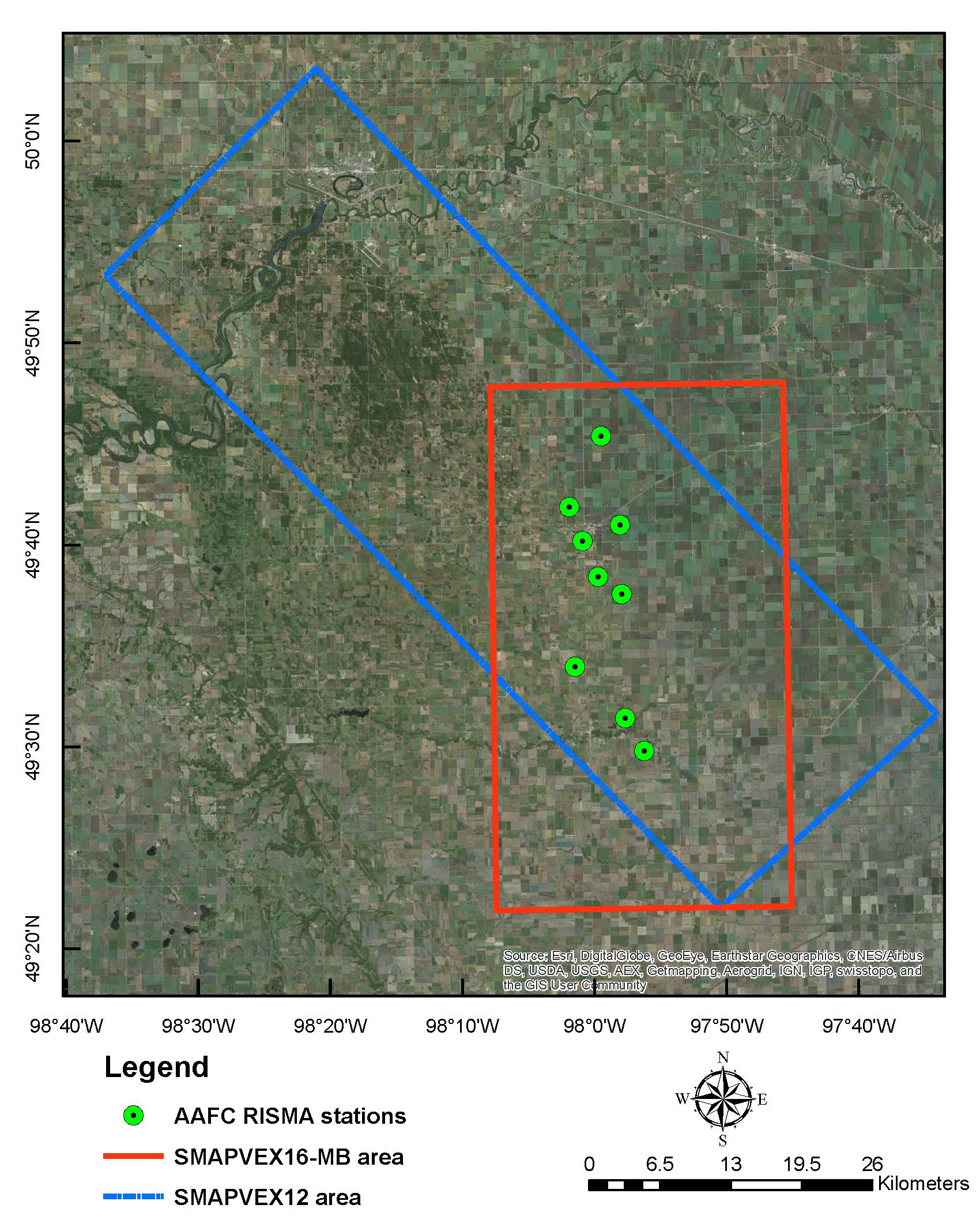

Overview of the study site
The SMAPVEX16-MB intensive sample site (26 km x 48 km) is located in the Red River Watershed (southern Manitoba). It is characterized by a mix of land covers dominated by annual cropping, wide range of crop and soil conditions. The high variability in soil moisture generally observed over the site resulted mainly from the spatial variability in soil texture. Indeed, the site captured diverse soil textures and showed a dramatic break between heavy clays and loams/sandy loams.
The SMAPVEX16-MB intensive sample site has been shifted east and south of the location of the 2012 experiment. It benefits from the Agriculture and Agri-Food Canada (AAFC) Real-time In-situ Soil Monitoring for Agriculture (RISMA) network, and weather networks from Environment Canada and Manitoba Agriculture, Food and Rural Development (MAFRD).