Specific description of the study site
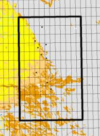
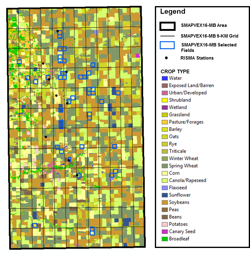
SMAPVEX16-MB intensive sample site mainly consists of annual crop fields distributed as follows:
| Crop type | Percent Area (%) |
|---|---|
| Soybeans | 29.88 |
| Spring wheat | 24.12 |
| Canola/Rapeseed | 18.24 |
| Corn | 8.28 |
| Oats | 6.92 |
| Deciduous forest | 2.29 |
| Grassland | 1.96 |
| Beans | 1.50 |
| Winter wheat | 1.41 |
| Sunflower | 1.12 |
| Others | 4.28 |
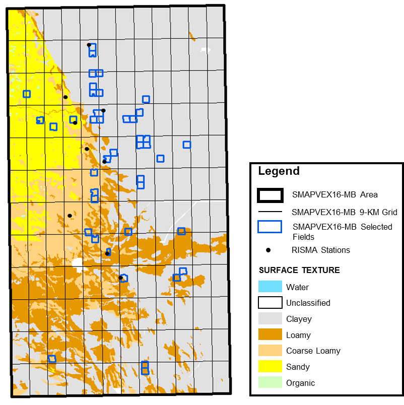
During SMAPVEX16-MB, about 50 fields of 800 m x 800 m each will be sampled. In order to properly address the research objectives, these fields are selected to be representative of soil textural conditions and annual crop types within the SMAPVEX16-MB area.
|
|
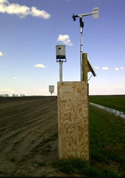
The Agriculture and Agri-Food Canada (AAFC) Real-time In-situ Soil Monitoring for Agriculture (RISMA) network installed over the site consists of nine in situ monitoring stations. They are selected to capture the soil texture variability over the site and thus are representative of the different soil texture classes (clayer, loamy, coarse loamy, sandy, etc.). Each station is instrumented with Stevens’ Hydra Probes which measures soil dielectric, soil moisture, and soil temperature, with triplicate measurements of the soil properties at each depth. Soil moisture and temperature are measured horizontally at depths of 5, 20, 50 and 100 cm, with an additional three probes placed vertically at the surface to capture integrated surface soil moisture over a 6 cm depth. Measurements are collected on a 30-minute time scale. Field specific calibration models have been applied to each sensor to obtain high accurate soil moisture values.

At each station, meteorological observations including liquid precipitation, air temperature, relative humidity, wind speed and wind direction are also captured at a 15-minute time frequency. In addition, Environment Canada and Manitoba Agriculture, Food and Rural Development (MAFRD) weather networks located within the agricultural regions of Manitoba collect various meteorological parameters that can be downloaded from:
